The First World War Mod: The Concept
For some time now, I’ve had a new idea for a Hearts of Iron IV mod. And this year I decided that, ambitious as the project is, it’s the perfect chance for me to refine all sorts of design skills, and that it’s time to make it happen.
What Mod?
HoI IV is a world war 2 grand strategy game created by Paradox Interactive. It’s one of my favourites for its broadly well-rounded mechanics, wonderful presentation, and of course the subject matter - the military operations of the second world war and the political bedrock underpinning it. I’ve already created a mod for this game - the Resource War mod (which has since been at least partially outmoded by Paradox’s introduction of depletable oil as an actual mechanic). That mod let me stretch my system-design legs a little, but what I have in mind here - a total overhaul mod setting the game in the first world war - would be much bigger.
I’m not the first modder to try and model World War 1 in HoI. However, existing mods tend to utilise the vanilla world map for HoI (modding the map is possible, but quite difficult), so you get the same provinces and terrain as you’d see in the typical World War 2 scenario. Something about this approach has always left me unsatisfied:
HoI has lots of provinces (these are tiles where soldiers and tanks can go) - much more than previous Paradox strategies like Europa Universalis IV. However, there’s obviously a technical limit to this. More provinces means more pathfinding nodes (not to mention more work from map creators). The resulting density of province looks like the vanilla screenshot above: a single tile is actually quite a large piece of land. There are only a few dozen tiles in Belgium and Northern France, where most of the Western Front fighting took place.
World War 1 was like its successive war in lots of ways, but the crucial exception was fidelity. In the second world war, cities and states were swept across in given battles or operations. But in World War 1, years were spent on the doorstep of tiny neighborhoods: entire battles centred on the capture or loss of tiny towns and rural woodlands. While World War 2 had the famous normandy invasion or case blau, World War 1 had such capers as The Battle of Ypres (Ypres is a small, unassuming town in west belgium). Verdun, maybe the most famous and devastating battle on the western front, was a minor city nested between the Argonne forest and the river Meuse, but the vanilla map doesn’t really have room for the Argonne or the famed city.
Strategic maps like this one show the territorial scale that slow-moving fronts in World War 1 centred on. The small green patch in the middle is the Argonne forest, scarcely representable by one of the provinces in the vanilla map, when in fact there were months of fighting over this area.
A World War 1 mod would better represent the tooth-and-nail battles of such a stagnant war with more provinces, more states, and more units. The solution is to zoom in.
The War in Europe
So the idea behind the mod is as follows:
Focus exclusively on the fighting in Europe. China and Japan are hidden off-map, as are the African and Pacific theatres (though these could be represented by popup events). Some important players, especially the USA, can play as off-map countries that arrive late-game to intervene in the war.
Scale up the fidelity of the European map: all the provinces of vanilla (more, probably), but covering a smaller geographic range with more detail. This lets me plot out those little fights over Verdun and Ypres, as well as the bigger campaigns such as the Brusilov Offensive.
Rebalance the game into a careful ‘war of attrition’ situation: lots of people argue that much of the war was a huge waste of strategic time, but that wouldn’t be so fun for a videogame. Instead, I’m taking the position that the tiny exchanges on the western front did matter: that Germany, for example, could have made it to Paris in their final offensive if they’d just taken Amiens a few years earlier, or that Russia was just a few lost battles away from avoiding their capitulation revolution.
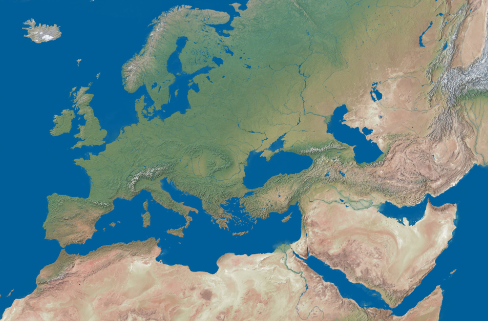
The map above is the base map I settled on after a few weeks of initial research. You may notice that unlike the vanilla game - which uses an adjusted sort of Mercator projection - my map seems pretty warped. That’s because it is. Warping a mercator in photoshop, I’ve created a map that enlarges Europe, fits in the Suez canal (which was very important in the British vs Ottoman fighting), features Iran (which was somewhat involved in the war, and may even be able to join as an ‘alt history’ feature), and shrinks unimportant areas such as the far north of Europe. I was careful (after a few tries) to create this map as a smart object in photoshop, which has proven to be an extremely important technique. It allows me to quickly overlay over mercator source maps with the same type of warp, like this topographic map for example:
Getting the basis of this map correct took a few weeks and some failed first-tries, but once I had it, I was ready to start populating the map (which is super fun).


